

Hiking to Bonita Falls – A perfect Californian daytrip within the San Bernardino National Forest

8 Author overlooking South Fork Lytle Creek tributary valley on the way back from Bonita Falls scaled
Posted July 14, 2024
San Bernardino National Forest
Hiking to a waterfall is likely not the first thing that comes to the mind when people are visiting Southern California, USA. Overwhelmed by all the well-known and frequently recommended must-dos, it is easy to miss the smaller and less famous opportunities like Bonita Falls, especially when it comes to spending time in nature .
Hiking to Bonita Falls is such an opportunity for those seeking some time outdoors. Located within the San Bernardino National Forest, the hiking trail to Bonita Falls is situated right at the outskirts of Los Angeles. It can be reached by a short 1.5 hour drive, depending on traffic. This general easy access makes the San Bernardino National Forest a perfect weekend getaway from the stressful city life of Southern California’s entertainment centre.
The journey at Bonita Falls hiking trail begins
My journey started from Apple White Campground, a camping area located only 5 minutes from the starting point of the Bonita Falls hiking trail. For those wanting to spend a little more time in the area, this campground offers a perfect place to stay. Not only is it equipped with actual toilets and water outlets, it is also close to Melody’s Place, a family-owned supermarket and restaurant/bar that supplies everything anybody could think of, such as the $5 permit (Adventure Pass) needed when parking inside the San Bernardino National Forest.
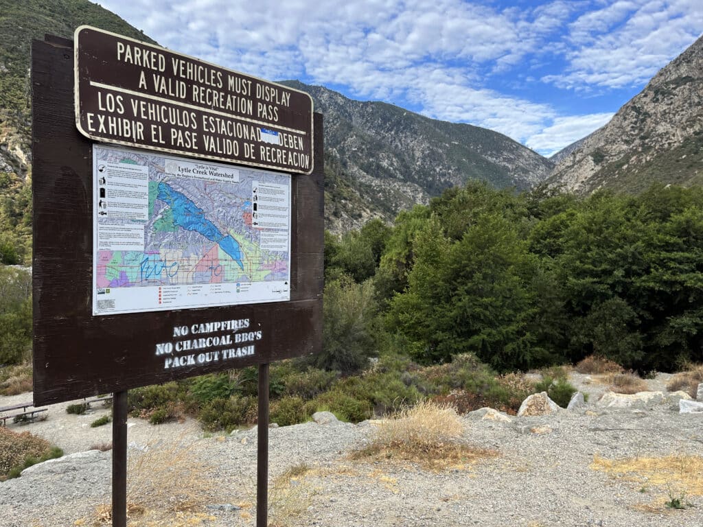
From Apple White Campground, I followed Lytle Creek Road back in the direction of Los Angeles for about 2 miles. Unfortunately, there is no sign clearly indicating where to stop. Although I only learned this later that day, I made the right decision to park the car on the side of the road right after passing the entrance to a place called Hidden Acres. Once I had parked the car, the fairly empty parking area quickly filled up. Driven by the idea of getting to the waterfall with as little people as possible, I started my journey immediately.
Crossing Lytle Creek
Although the general navigation towards Bonita Falls is pretty straight forward, it is quite easy to feel a little lost during the initial 5-10 minutes of the hike. Once I left the car, I passed the entrance to Hidden Acres (to my left) and followed Lytle Creek Road for about 2 minutes back the same way I just came from until I saw the actual creek, Lytle Creek, down to my left. I climbed down towards the creek and crossed it by carefully stepping over one of many dams made of rocks and wooden pieces.
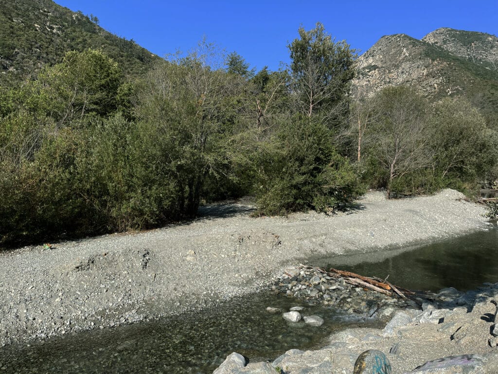
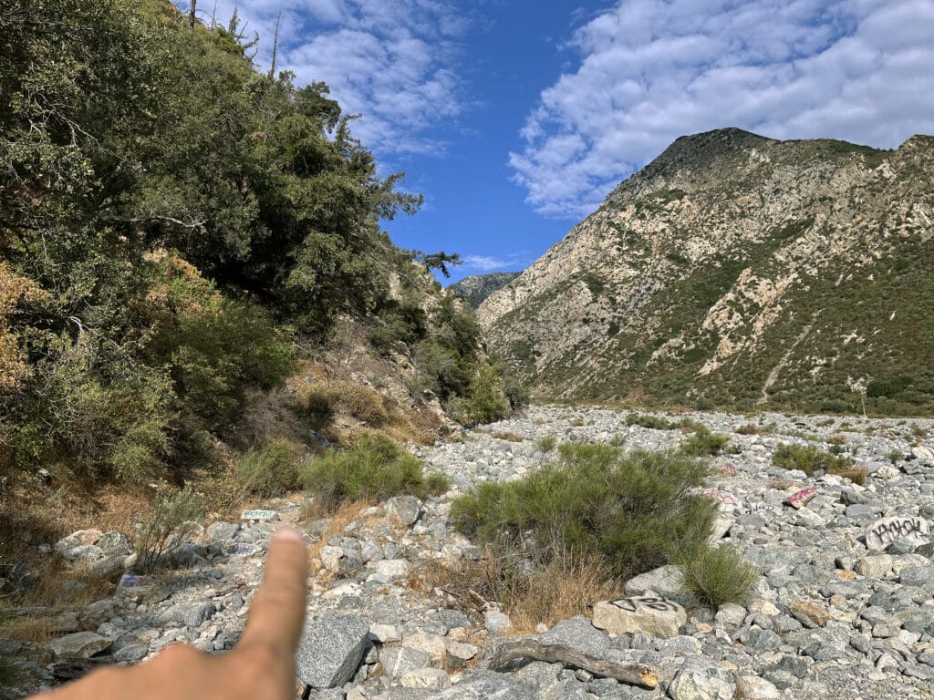
At the other side of the creek, I soon found a little path leading through some dense bushes. Not exactly sure whether or not this was right, I decided to follow the trail that ended up leading me towards a big opening called South Fork Lytle Creek, a tributary of Lytle Creek that was entirely dried out.
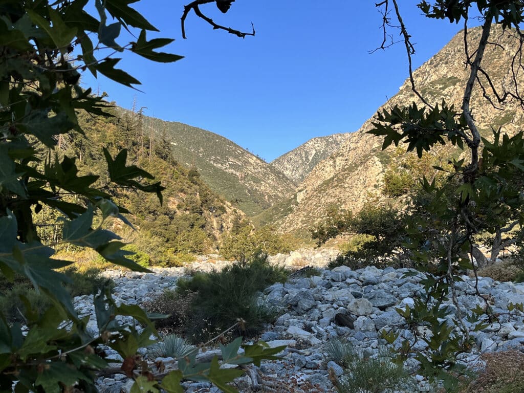
Once I entered the huge plateau-like valley, I turned around to memorize the way back to the car. Looking at the bushes covering Lytle Creek, I spotted a huge number of people slowly making their way towards the valley after crossing the creek. I then realized there were uncountable ways to get to Bonita Falls. When on this hike, it’s not necessary to overthink your current position. You don’t need special navigation skills, as not much can go wrong when trying to find the “right” way.
Navigating towards Bonita Falls
The entire valley consists of fine sand, large boulders, and everything in between. Although there was no clear hiking path, walking alongside the bottom of the mountain to my left gave me the most shade and provided quite even grounds to walk on.
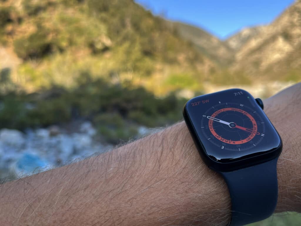
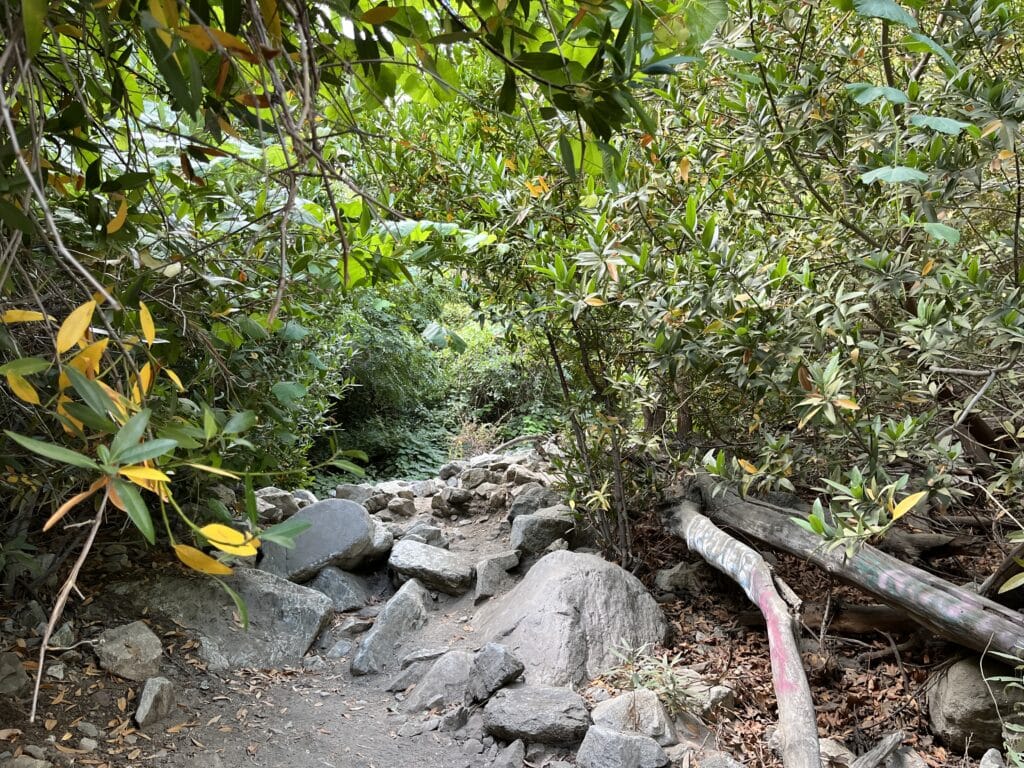
After about a quarter mile, I took a left turn that led uphill into the mountain’s forest. This turn would be hard to miss since moving further alongside the valley was no longer possible. The last 5 minutes of the hike consisted of gaining roughly 300 feet (100 meters) of elevation. Although a bit of climbing boulders was needed here and there, the overall ascend was quite easy, very intuitive, and should soon reward me with an amazing view.
Reaching Bonita Falls
After climbing one last boulder and walking past one last tree which had blocked my view, there it was. Beautiful, majestic, and comfortably nested within the stony cliffs of the surrounding mountains, the 100-foot (30 meters) waterfall welcomed me at 07:30 AM. For the next 10 minutes, I was all by myself and couldn’t believe my eyes. Looking at pictures of the waterfall before starting my trip was one thing. Physically standing in front of this natural masterpiece was incomparable. Although there was probably not much water compared to fall or winter, the Bonita Falls looked absolutely amazing. Especially since many waterfalls dry out throughout the hot summer months in California, while the beauty of this place can be observed all year round.
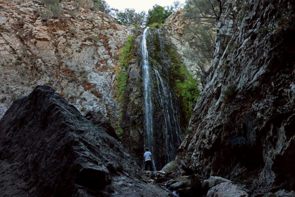
After snapping some great pictures, I sat down and enjoyed the scenery. I suggest getting to the waterfall by around 7 AM, as by the time I left at around 9 AM, the small area around the waterfall, was packed with visitors. I liked this trail so much, I even returned the next day to hike it again. The biggest benefit of this hike is definitely its easy-to-moderate level. The 3-miles roundtrip trail is easily doable for people of all fitness levels and offers an amazing landmark as a reward.
COVER: Author overlooking South Fork Lytle Creek tributary valley on the way back from Bonita Falls
Where to Stay Near San Bernardino National Forest, California, USA?
Use the interactive map below to search, compare and book hotels & rentals at the best prices that are sourced from a variety of platforms including Booking.com, Hotels.com, Expedia, Vrbo, and more. You can move the map to search for accommodations in other areas and also use the filter to find restaurants, purchase tickets for tours and attractions, and locate interesting points of interest!
Join the community!

Join our community to receive special updates (we keep your private info locked.)

